March 31, 2026

IMAGE OF THE WEEK

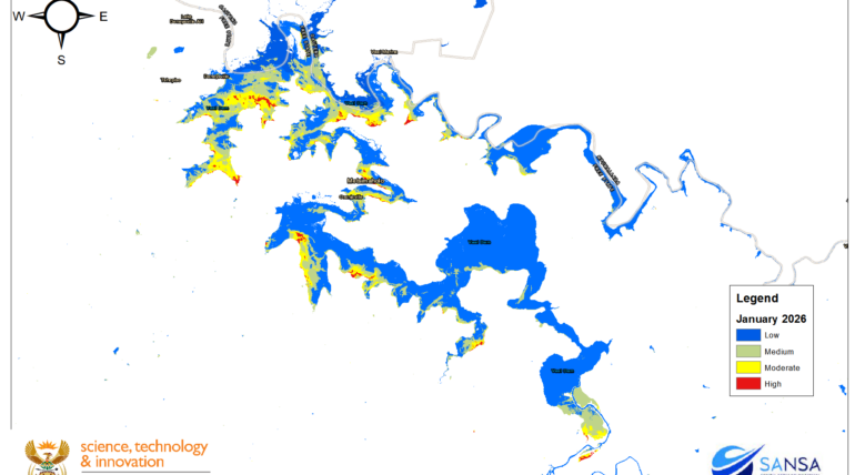
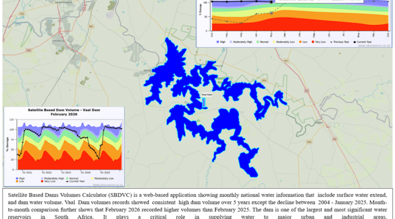
Map extracted from a satellite-based Dam Calculator shows consistent high water volumes at the Vaal Dam over the past five years, except for a decline in January 2025. Month-to-month comparison further shows recoded higher volumes in February 2026 than

March 16, 2026

IMAGE OF THE WEEK

PlanetScope (Dove) Satellite- 3m Spatial Resolution natural colour Image, captured on 10 March 2026 show Soshanguve Block S landfill site highlighted in blue, and the surrounding human settlements. The site has been a key municipal waste disposal facility in northern

January 14, 2026

SANSA Uses Earth Observation Satellite Imagery to Observe Fires

Earth observation satellites provide near-real-time information for detecting and monitoring wildfires, supporting informed decision-making during fire events and assessing post-fire impacts. SANSA leverages satellite data with low to high spatial and temporal resolution to support all phases of the

1 2 3 5