June 9, 2026
IMAGE OF THE WEEK
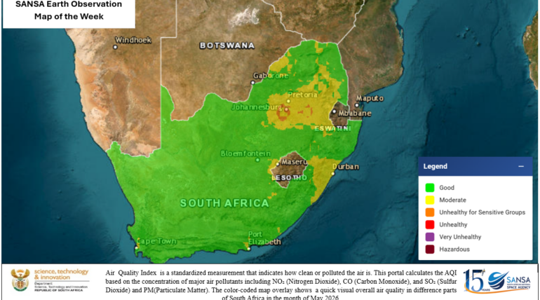
The overlaid map shows that most parts of the country experienced good air quality during the month of May. However, moderate air quality conditions were observed in some eastern and northern regions of the country. Parts of Gauteng and