The South African National Space Agency (SANSA) has reaffirmed its...
Read More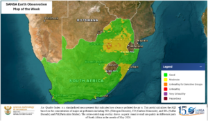
IMAGE OF THE WEEK
The overlaid map shows that most parts of the country...
Read More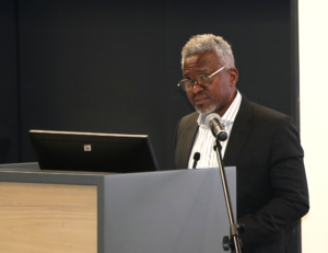
Second ICAO Space Weather User Workshop
Opening Remarks by Mr. Humbulani Mudau, CEO of SANSA SANSA...
Read More
Launch Your Future with a SANSA Postgraduate Bursary
Applications Now Open! Are you ready to reach for the...
Read More