April 5, 2023
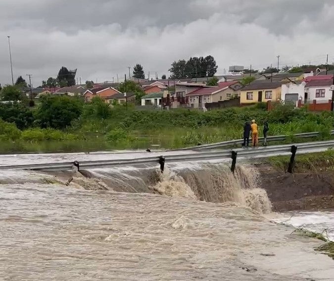
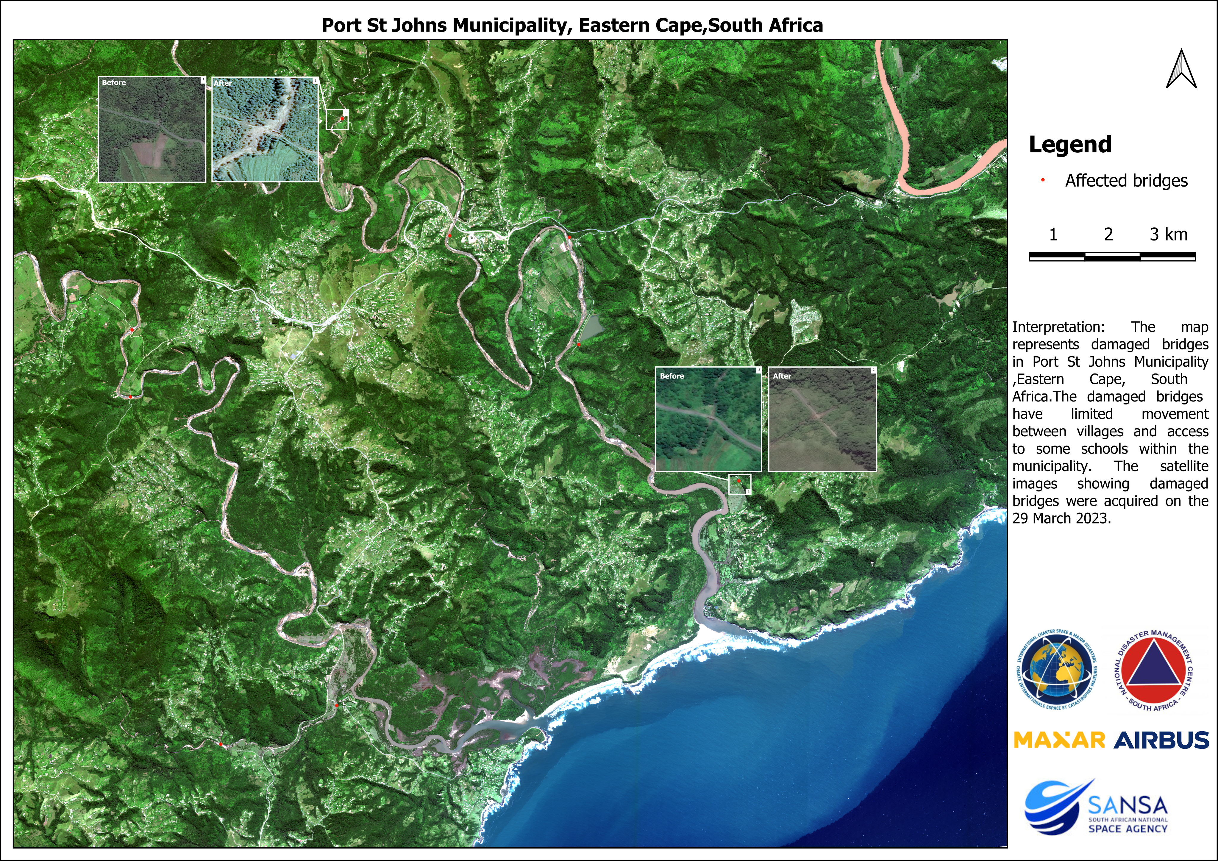
The South African National Space Agency (SANSA) uses Earth Observation Satellite data to aid authorities and businesses in the Eastern Cape Province flooding
[caption id="attachment_13457" align="alignleft" width="652"] Satellite image over Port St John showing flood affected areas[/caption] The South African National Space Agency (SANSA) used Earth Observation Satellite data to map infrastructure damage following the heavy rainfall and flooding in Mnquma, Mbashe,