April 14, 2025
The South African National Space Agency (SANSA) continues to play a vital role in maritime environmental protection and security through its comprehensive Earth Observation (EO) sensor portfolio by collecting, processing, archiving, and disseminating Earth Observation data. This data supports policymaking, decision-making, economic growth, and sustainable development in South Africa.
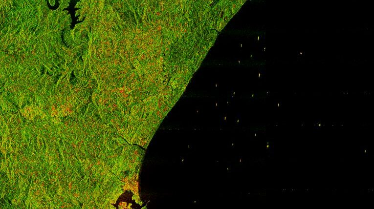
As part of its ongoing efforts to support the Operation Phakisa initiative, in particular oceans economy, SANSA is acquiring systematic RADARSAT 2 satellite images over South Africa’s Exclusive Economic Zone (EEZ) including Prince Edward and Marion Islands on a weekly basis. The images are integrated into National Oceans and Coastal Information Management System (OCIMS), project managed by Department of Forestry Fisheries and the Environment to develop decision support tools and improve South African Maritime Domain Awareness.
These images contribute to development and delivery of near real-time alerts of activities around South Africa’s EEZ through OCIMS Integrated Vessel Tracking decision support tool. Between 2018 and 2020, SANSA supported OCIMS project by providing around 1000 RADARSAT 2 images.
RADARSAT-2 images provide detailed data that is crucial for monitoring coastal and maritime activities, detecting environmental changes, and improving decision-making across various sectors. The imagery will play an essential role in SANSA’s mission to support ocean governance, fisheries management, and disaster risk reduction efforts.
Through the OCIMS initiative, RADARSAT-2 imagery will assist in detecting oil spills, tracking of illegal fishing activities, and assessing coastal erosion. Additionally, the data will contribute to projects focused on agriculture, water resource management, and urban development, aligning with South Africa’s strategic objectives for sustainable development and resilience against climate change.
SANSA remains dedicated to advancing Earth observation capabilities through international collaborations and technological innovation. The integration of RADARSAT-2 imagery is part of its broader strategy to enhance situational awareness and support South Africa’s economic development through space-based solutions.
SANSA’s Earth Observation sensor portfolio is designed to support decision-makers in government and the private sector by providing satellite data for the management of natural resources, disaster response, food security and agriculture, human settlements, ecosystems and biodiversity, marine and maritime activities, and infrastructure planning.
Clients in both the private and public sectors can access RADARSAT-2 data and other SANSA’s satellite products and services by contacting customer services at customers-eo@sansa.org.za.
For more information contact:
Khumbulani Mkhize, EO Marketing Specialist
Vaneshree Maharaj, Communications Manager
About the South African National Space Agency
At SANSA we believe in creating an infinite impact for the benefit of all South Africans through technological advancement and innovation. The agency was established in 2010 through the South African National Space Agency Act, 36 of 2008. SANSA aims to promote cooperation in space-related activities, foster research in space science, advance scientific engineering through human capital and support development of an environment conducive to industrial development in space technologies.