
August 21, 2026
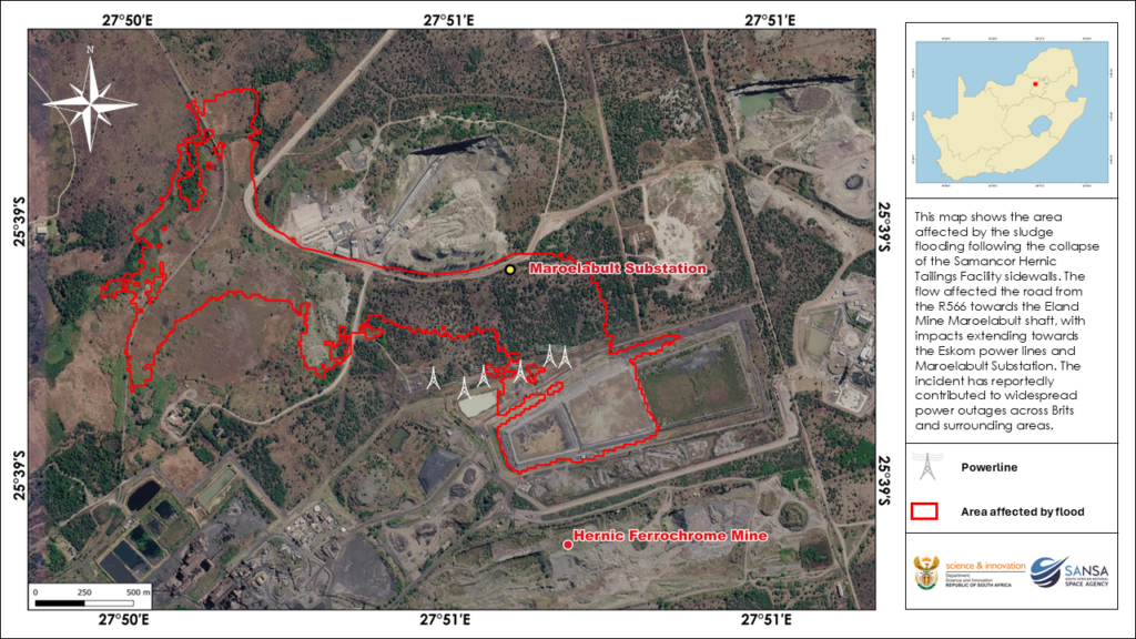
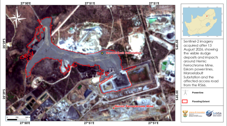
The South African National Space Agency (SANSA) is using satellite Earth Observation (EO) intelligence to map and analyse the impact of the Hernic Ferrochrome tailings dam collapse near Brits. The analysis provides a clear spatial view of the downstream movement and deposition of tailings and sludge across the mining area, highlighting impacts on access roads and surrounding infrastructure. Sentinel-2 imagery acquired after 13 August 2026 confirms extensive visible sludge deposition around the Hernic Ferrochrome mine, with impacts extending towards the Maroelabult Substation and Eskom power lines. The affected access route from the R566 is also visible, demonstrating the disruption to critical mining, transport and electricity infrastructure. By rapidly delineating the affected area, satellite imagery provides valuable information for understanding the scale and geographic extent of disaster impacts.
This analysis further demonstrates the value of Earth Observation intelligence in supporting rapid disaster assessment, response and recovery. Satellite-based monitoring, including optical and radar remote sensing, can provide authorities with timely spatial information during and following disaster events, helping to quantify affected areas, identify infrastructure at risk, support damage assessments and inform evidence-based decision-making. These outputs can assist disaster management authorities and other stakeholders in identifying affected communities, prioritising emergency response interventions and supporting post-disaster planning. SANSA Earth Observation continues to demonstrate how space-based intelligence can be translated into practical information for decision-makers.
To access detailed reports, maps or Earth Observation imagery and Decision Support Tools, please contact SANSA Customer Services at customers-eo@sansa.org.za or Khumbulani Mkhize at kmkhize@sansa.org.za.