January 17, 2026
Climate-related extreme rainfall events are becoming more frequent, and Earth Observation (EO) is increasingly vital for identifying risk areas, informing planning, and supporting early or rapid response. Earth observation satellites provide near-real-time information for detecting and monitoring floods, supporting decision-making before floods through flood risk maps and post-flood damage assessments. SANSA uses a series of satellite images and their analyses, at low to high spatial resolutions, to support a significant part of the disaster management cycle. SANSA uses a suite of models, including the digital elevation model, to simulate the flood risk and inundation areas. Working closely with the National Disaster Management Centre (NDMC) in line with the Disaster Charter and other government entities, SANSA will analyse satellite imagery to support the response to the current floods in Limpopo and Mpumalanga provinces.
With support from the Department of Science, Technology and Innovation (DSTI), SANSA is currently developing a decision-support tool to improve the predictive capabilities for flood risk areas by integrating multiple data sources, including multi-sensor satellite or Earth observation data, artificial intelligence, and machine learning.
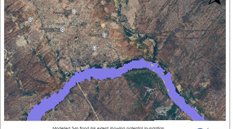
The maps show flood risk areas along the river corridor near Vuhehli village in Greater Giyani. The map below shows a modelled 3-m flood risk extent with historical Sentinel-2 images, indicating areas potentially inundated during high river levels and highlighting vulnerable areas to riverine flooding.
SANSA will support the government and municipalities in assessing the damage caused by the current floods in Limpopo by leveraging open-access and commercial satellite data. More images to follow on this platform.
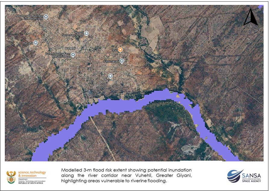
Map: indicating flood risk areas along the river in Vuhlehi village close to Giyani. The extent of the flood will be determined from the latest satellite images.
Some examples of the work SANSA did across the Country can be found at the link below.
SANSA’s Earth Observation division continues to analyse and map floods in Limpopo to assist the government in supporting post-flood recovery efforts. To access detailed reports, maps or data over other areas, please contact customer services at customers-eo@sansa.org.za and KhumbulanI Mkize at kmkhize@sansa.org.za