September 14, 2022
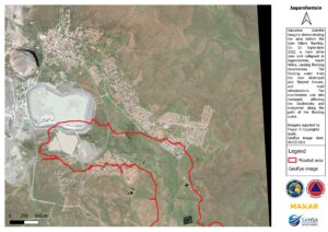
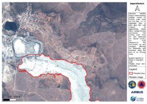
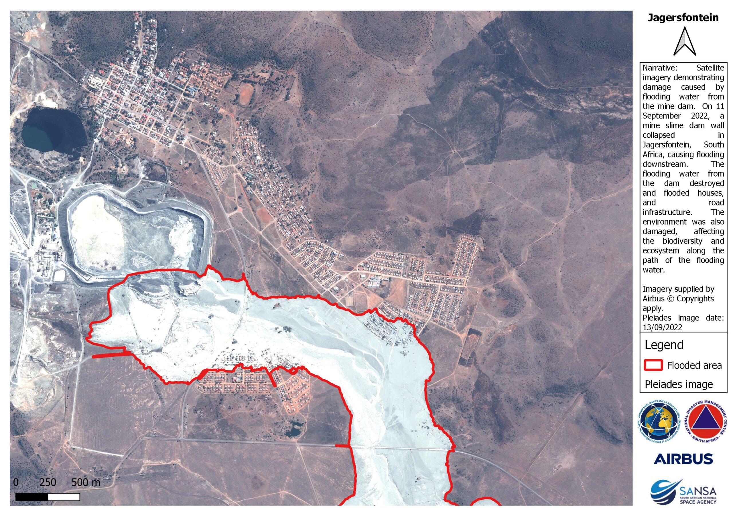
The South African National Space Agency (SANSA) has released Satellite Imagery following the Jagersfontein Dam flooding in the Free State on 11 September 2022. Early on Sunday morning, a dam in Jagersfontein in the Free State Province burst its walls causing damage to property and the loss of lives.
The intelligence derived from SANSA’s Earth Observation satellite data can be accessed by the National Disaster Management Centre, local authorities and affected businesses to aid the disaster response efforts and to quantify the damage caused by floods.
Data is being analysed by SANSA to map the extent of damage to property and infrastructure in flood affected areas. Earth Observation derived intelligence will aid in conducting post-flooding disaster quantification and supports the estimation of overall damage, thus indicating the importance of such data in government response efforts. This information is critical for government and business to establish the financial requirements and priority areas to focus on in order to ensure the saving of lives and limited impact on the economy as well as improved planning at municipalities.
SANSA has developed disaster management tools that can provide relevant authorities with early warning of floods and information on high-risk flooding areas. SANSA also has a capability to monitor flooding and provide authorities with relevant satellite imagery to assist with post flood disaster management.
The accompanying Earth Observation derived Imagery showcases the areas affects by floods. For more information on access to the data contact SANSA customer services through customers-eo@sansa.org.za