November 5, 2021
It’s a simple fact of life that without ‘amanzi’, which means ‘water’ in Zulu and Xhosa, life on Earth would not be possible. SANSA is playing its part to ensure the sustainability of water supply in Mzansi for generations to come.
SANSA has a legislative mandate to acquire, archive, process and share satellite imagery. This is so as to enable the development of data and information products for the use and benefit of the public sector and the Earth observation community. SANSA has made a commitment to continually develop innovative solutions in the form of earth observation data to assist authorities in their decision-making processes.

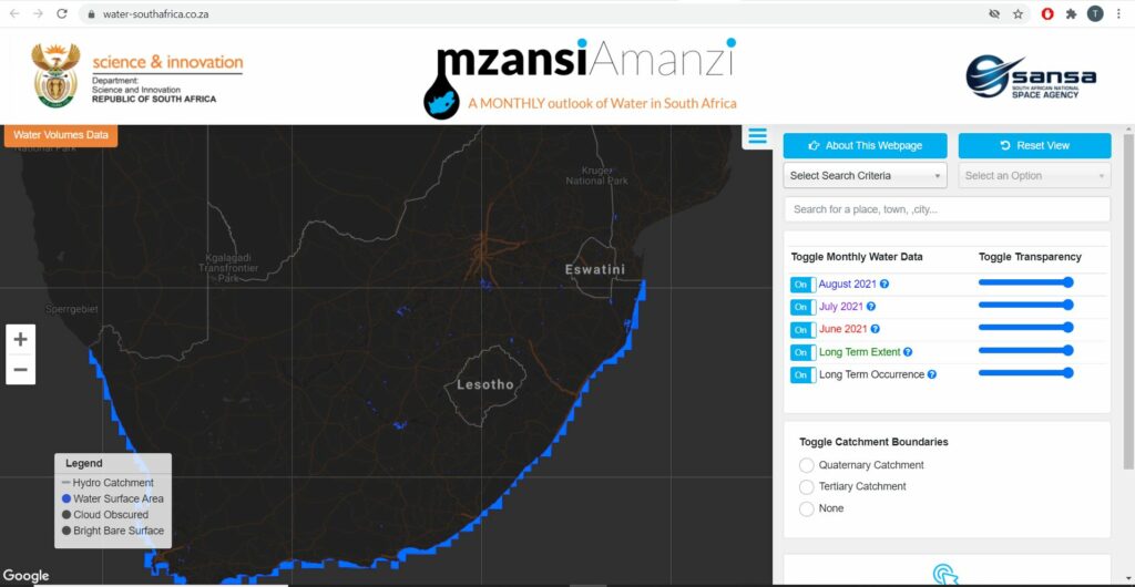
In the process of creating solutions to monitor water resources in South Africa, SANSA has entered into a multi-user agreement with two companies from the private sector, GeoTerraImage and Ekosource to provide satellite-derived information to government entities for the purpose of water resource management and monitoring through the National Water Quantity Information Service, also known as the ‘Mzansi Amanzi’ tool.
How it works
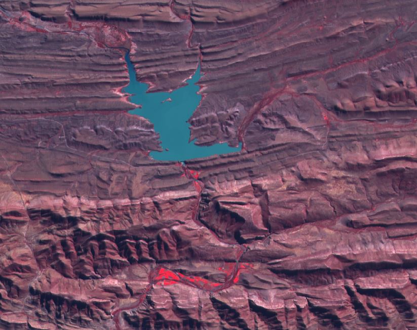
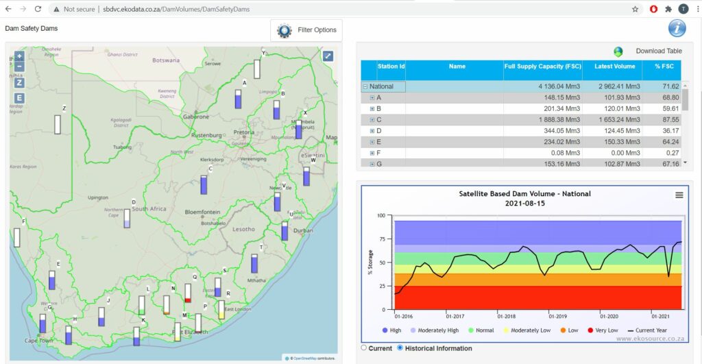
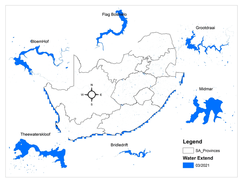
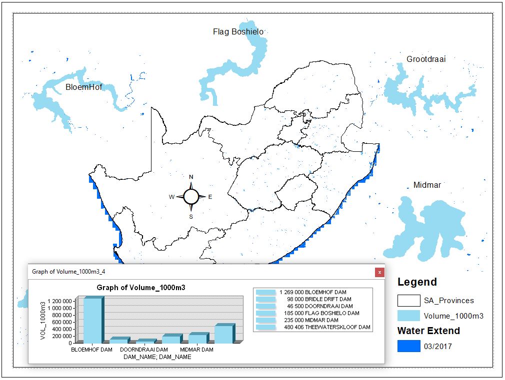
The Mzansi Amanzi tool uses Sentinel-2 satellite data to calculate surface water area and dam water volume levels across South Africa on a monthly basis. These calculations assist water resource managers in making important decisions in terms of water security, as the information enables them to accurately estimate the available water supply volume in particular areas. The monthly data gives volume and surface area histories of individual dams dating back to 2016, including volume and surface area summaries per catchment.
The Mzansi Amanzi monthly water datasets (2016 – current) distributed by SANSA are supplied in GIS compatible raster and vector file formats. The datasets are made available for each new assessment month by the 15th day of the following month, for example October 2021 data will be available by 15 November 2021.
This monthly water resource monitoring information is freely available to all South African government and state entities, and it can be also used by consultants working on projects for such entities.
To find out more about the Mzansi Amanzi tool, please contact SANSA’s customer services team by emailing SANSA Earth Observation at customers-eo@sansa.org.za