April 5, 2023
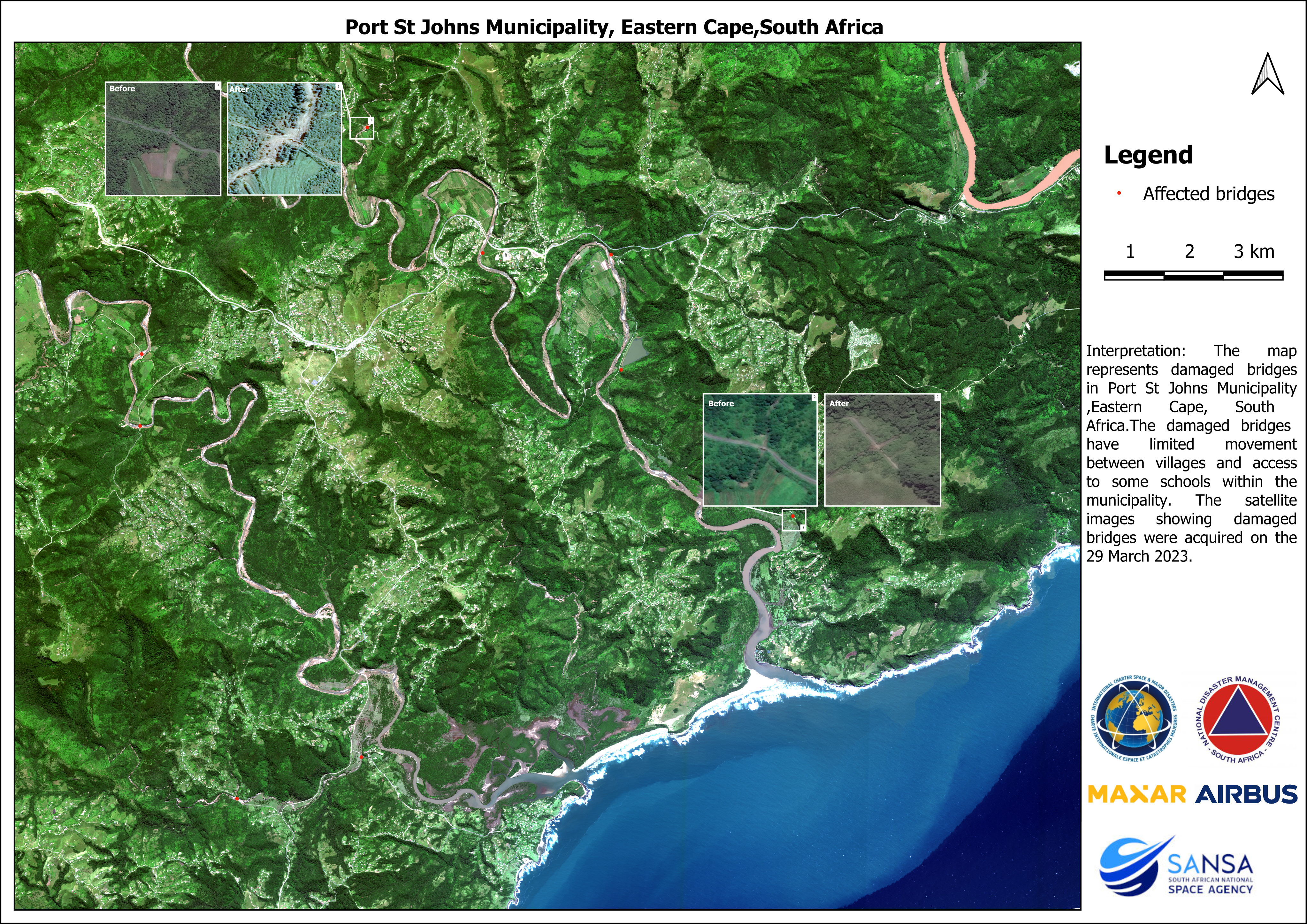
The South African National Space Agency (SANSA) used Earth Observation Satellite data to map infrastructure damage following the heavy rainfall and flooding in Mnquma, Mbashe, King Sabatha Dalindyebo, Nyandeni, Port St Johns, Ingquza and Mbizana municipal areas of Eastern Cape Province on 23 March 2023.
SANSA, working with the National Disaster Management Centre, activated the International Charter; Space and Major Disaster on 27 March 2023. The activation of the charter enables the owners of earth observation satellites who are part of the charter to prioritise image acquisition over the areas affected by flood in Eastern Cape province.
The flood damage maps derived from Earth Observation satellite data are accessed by the National Disaster Management Centre, local authorities and affected businesses to aid disaster response efforts and to quantify the damage caused by floods.
SANSA also developed disaster management tools that can provide relevant authorities with early warning of floods and information on high-risk flooding areas. SANSA also has a capability to monitor flooding and provide authorities with relevant satellite imagery to assist with post flood disaster management.
The accompanying Earth Observation derived map showcases the areas affects by floods. For more information on access to the data contact SANSA customer services through customers-eo@sansa.org.za