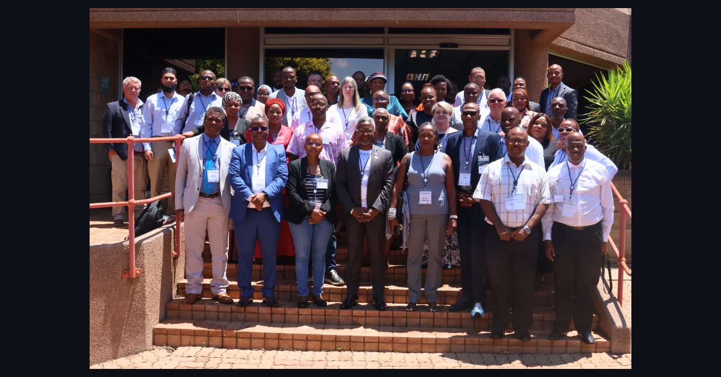
 The South African government is moving toward a coordinated national approach to satellite imagery procurement in a strategic effort expected to significantly reduce costs, strengthen data sovereignty, and enhance evidence-based planning across the public sector. The...
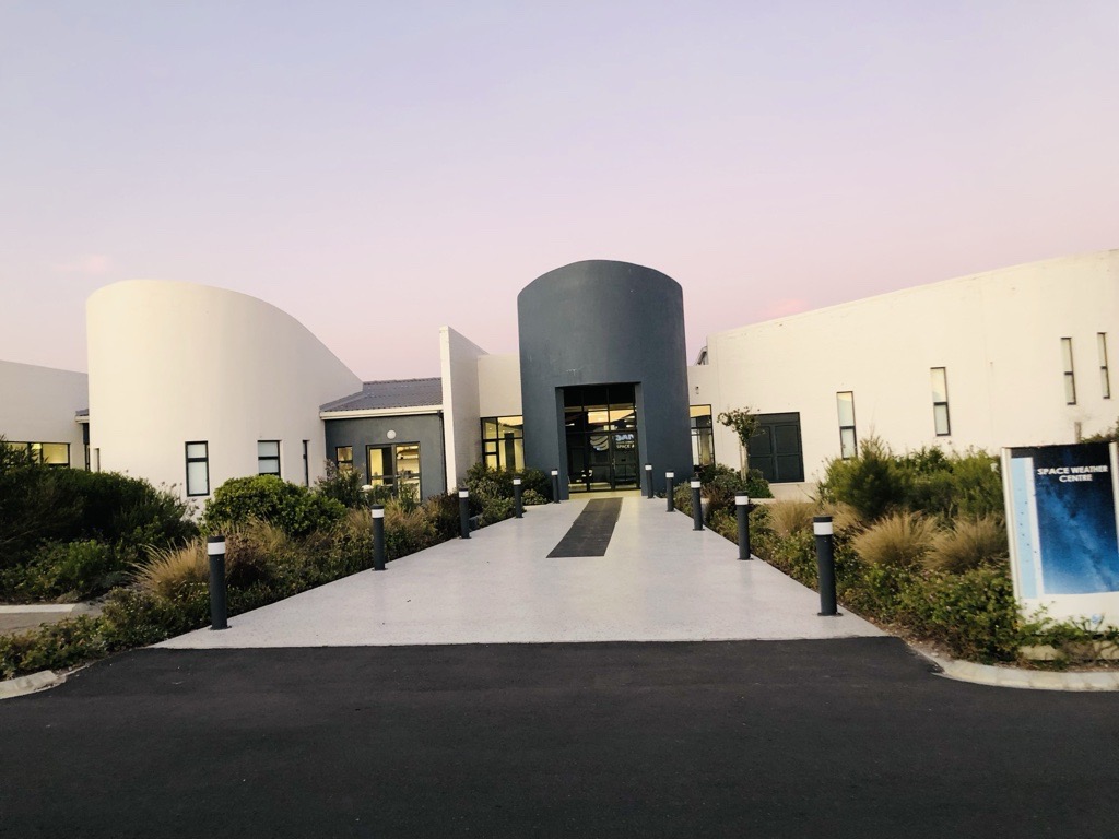 Last week, the South African National Space Agency (SANSA) was honoured to welcome two groups of delegates to its Hermanus site in the Western Cape to showcase the facility’s current successes and future growth potential. On Wednesday, 28 January 2026, the...
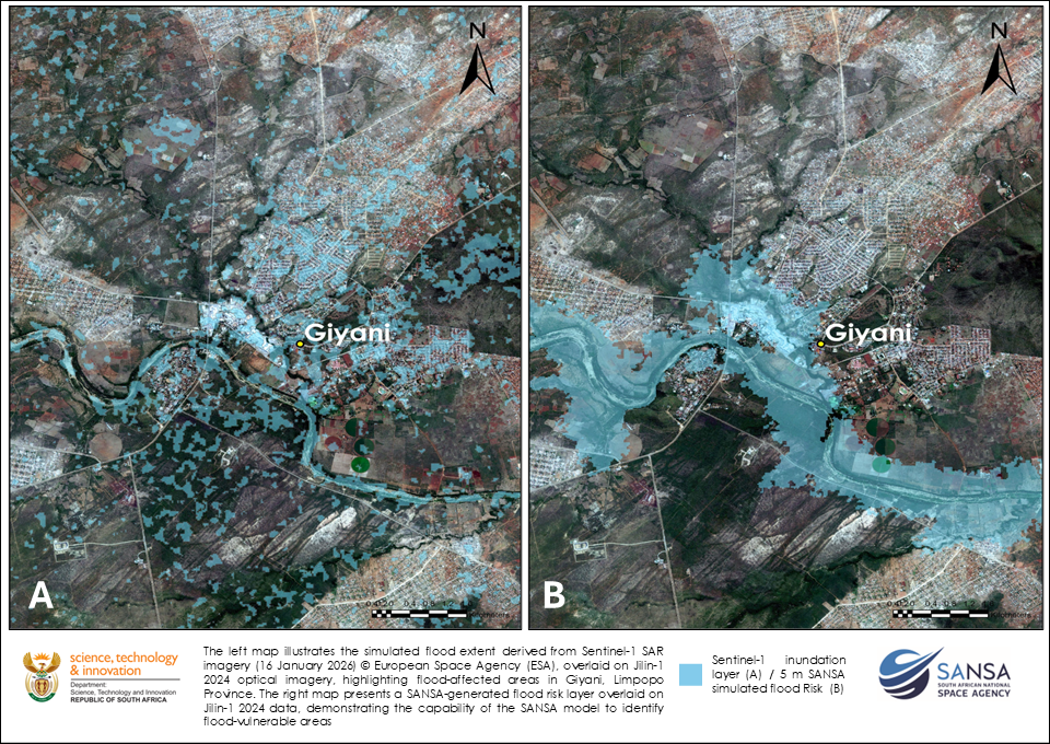 SANSA’s Earth Observation produced flood extent maps for Giyani and Vuhehli in Limpopo Province following the January 2026 flooding, using Sentinel-1 Synthetic Aperture Radar (SAR) imagery acquired on 16 January 2026. By analysing pre- and post-event SAR data, SANSA...
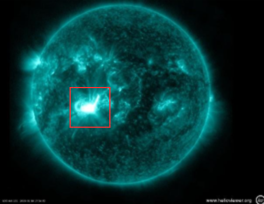 UPDATE at 10:00 on Wednesday, 21 January 2026 Global geomagnetic conditions were at G2/Moderate to G4/Severe storm levels (Kp 6-8) in the past 24 hours with a G4/Severe storm at about 02:00 (South African Standard Time) this morning. Storm conditions are expected to...
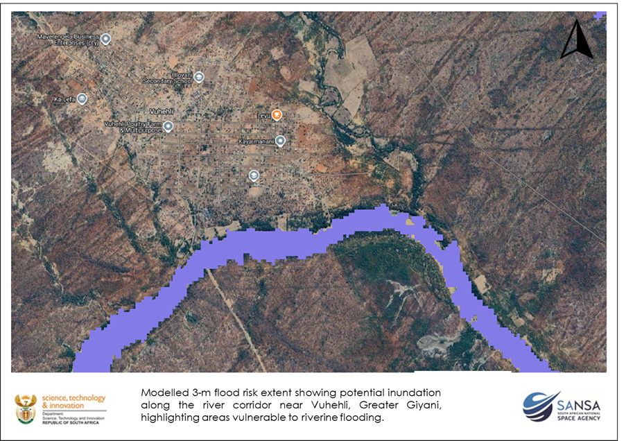 Climate-related extreme rainfall events are becoming more frequent, and Earth Observation (EO) is increasingly vital for identifying risk areas, informing planning, and supporting early or rapid response. Earth observation satellites provide near-real-time information...