 Space investment remains an important means of ensuring South Africa’s role in contributing to and utilising space science, technology and innovation for the benefit of all citizens on the continent. The South African Government through the Department of Science and...
 The USGS Landsat International Cooperator Network, in coordination with the South African National Space Agency (SANSA), will be hosting the first in person Landsat Ground Station Operators Working Group (LGSOWG) #50 meeting since 2019 in Pretoria, South Africa during...
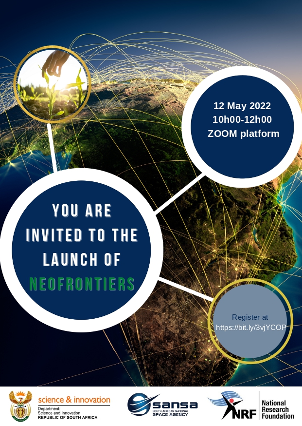 ANNOUNCEMENT: To Earth Observation Community ANNOUNCEMENT FOR THE NEW DATES OF THE NEW EARTH OBSERVATION FRONTIERS (NEOFRONTIERS) LAUNCH AND INFORMATION SESSION. It is with great pleasure to announce the new dates for the NEOFrontiers launch and information session....
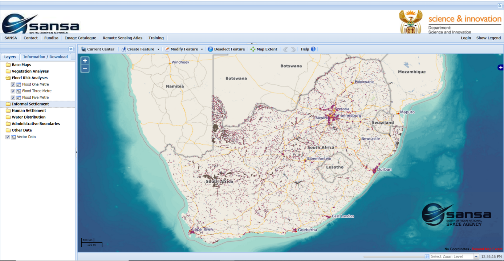 A new tool providing spatial information layers showing potential flood inundation scenarios alongside human settlement layers and allowing rapid visual assessment of areas most vulnerable to flood damage has been developed at the South African National Space Agency....
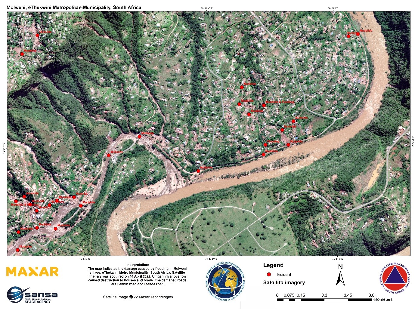 The South African National Space Agency (SANSA) together with its international stakeholders have obtained the Earth Observation Satellite Imagery in the areas that are affected by floods in KwaZulu Natal and some parts of the Eastern Cape. The intelligence derived...